Home / Solutions / Live Mine Map & GIS
Live Mine Map &
Enterprise GIS
Production deployed
Product maturity · Data and deployment requirements
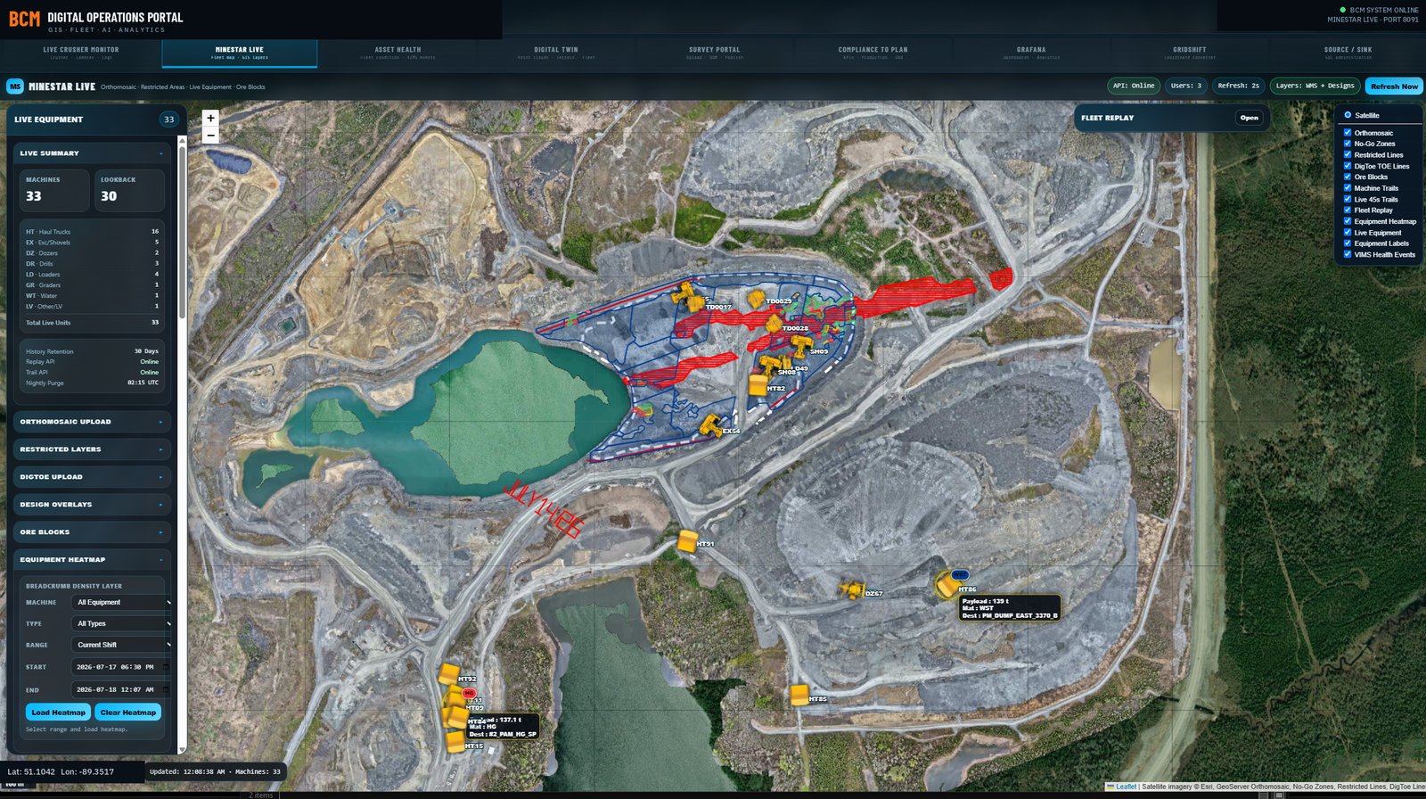
One map, shared by everyone: live equipment positions from your fleet management
system, this month's orthomosaic, design surfaces, restricted areas, and field data,
in a browser, with no per-seat BCM charges deciding who gets to see the mine.
Capabilities
The whole operation, one URL.
Live
Real-Time Fleet Positions
Positions ingested on a two-second loop, with breadcrumb trails, frame-by-frame
replay including ghost trails, and utilisation heat maps over any shift or custom window.
The control room view, available to anyone you choose.
Layers
Ortho & Design Overlays
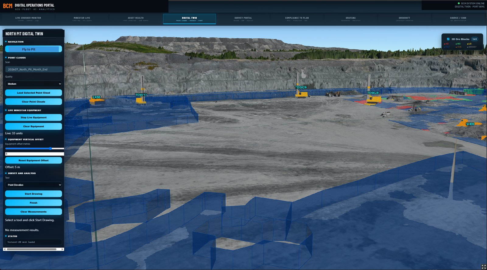
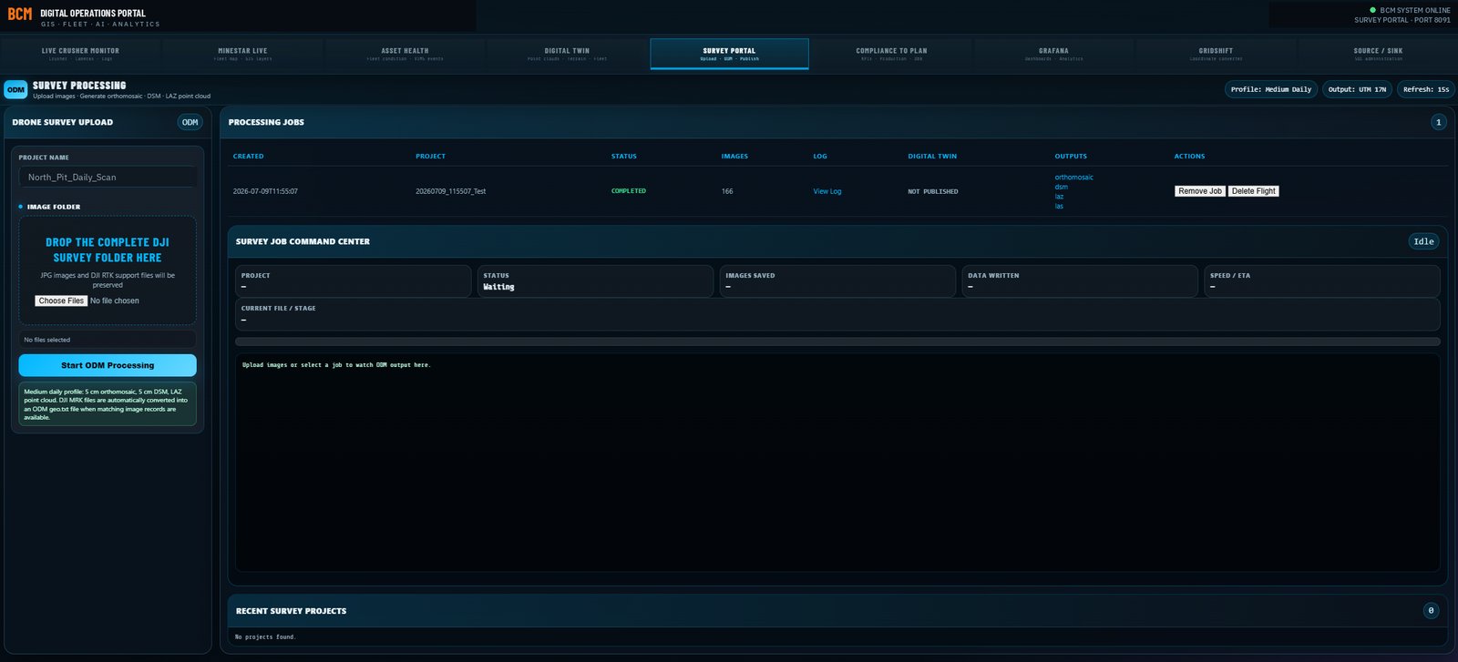
Fresh orthomosaics, CAD design surfaces, dig limits, restricted areas and survey
products on QGIS, GeoServer and PostGIS. Ore blocks overlay from the fleet system with
site, bench and material filtering, and a surveyor can drop a DXF into the browser to
replace the restricted area layer live, without anyone touching the GIS server.
Audit trail
Every Upload Has A Name On It
Anything published to the platform is attributed to a domain-authenticated user
rather than to whoever had the page open: restricted area boundaries, orthomosaics, point
clouds, design surfaces. Each one records who uploaded it, when, and what it replaced.
That turns a shared tool into one an operation can put a controlled change through,
because the record is not a matter of trust and it survives the person leaving.
Field
Mobile Field Mapping
QField tools for crews in the pit: capture, inspect, and sync back to the office,
offline-capable for the corners of the property radio forgot.
Access
Your Directory, Not Another Password
Sign-in authenticates against your own Active Directory over LDAPS with full
certificate validation, so there is no second identity store to provision, no separate
password policy, and nothing to clean up when somebody leaves. Authorization reads the
security groups your IT group already maintains, which means engineering, survey and pit
operations get different rights without anybody building a new access list.
Screenshots from production systems. Site identifiers, serial numbers and personnel details have been altered. Public demos use synthetic data.
See a live map running now, on a synthetic demo mine: route performance, grade and speed maps, road loss, replay →
Fleet intelligence / terrain & GIS
Scope the capability before deployment.
Dispatch and technical services need fleet, roads and current designs in one view.
Built and running in mine operations. The implementation examples show the workflow and outputs. The Technology & Data Assessment defines the data connections, configuration and acceptance criteria for your mine. Public demonstrations use synthetic data.
- What it doesPositions and equipment states, recent movement, route performance, road speed and grade, road time-loss estimates, fleet idle monitoring, production pulse, shifter maps, ping freshness, orthomosaics and restricted/design layers.
- Data requiredApproved fleet position/state feed; surveyed coordinate reference; current orthomosaics and designs; connectivity status if available.
- PrerequisitesRead-only source access, IT approval, coordinate/control checks, position quality and an agreed refresh/retention policy. Road-loss estimates require validated cycle and position coverage.
- OutputsBrowser fleet map, equipment details, trails and heatmaps; route/road investigation layers and freshness indicators.
- ImplementationAccess, integration, cybersecurity and data quality are assessed before duration or acceptance is committed. Existing workflow descriptions are not delivery guarantees.
View Live Mine Map demo ↗
Commercial engagement
Software subscriptions provide platform access and include applicable updates, defect fixes and standard product maintenance. Optional Premium Support is $50,000 CAD per mine annually for additional operational assistance under agreed service terms. Custom development, new integrations, custom reporting, specialized analysis and advanced troubleshooting outside support scope are separately billed consulting at $260 CAD/hour, unless expressly included in a signed agreement. All amounts exclude applicable taxes.
Implementation is quoted for deployment requirements. No consulting hours or Premium Support are automatically bundled with software. Estimate software, support and consulting.
Technology & Data Assessment Full pricing and service boundaries →
Related solution modules · Technical case studies · Request an assessment
 BCM