 BCM
Home / Case studies / Terrain publication
Terrain publication
implementation study.
Get accepted survey products into operational maps while keeping coordinate assumptions visible.
Evidence & maturity
Production deployed. This study describes the implemented workflow, its outputs and operating limits. Screenshots are implementation examples; no customer endorsement or quantified financial result is claimed.
Implementation
Process authorized imagery or point clouds, validate control and transformation residuals, publish orthomosaic/terrain layers and retain capture/version metadata alongside mine designs.
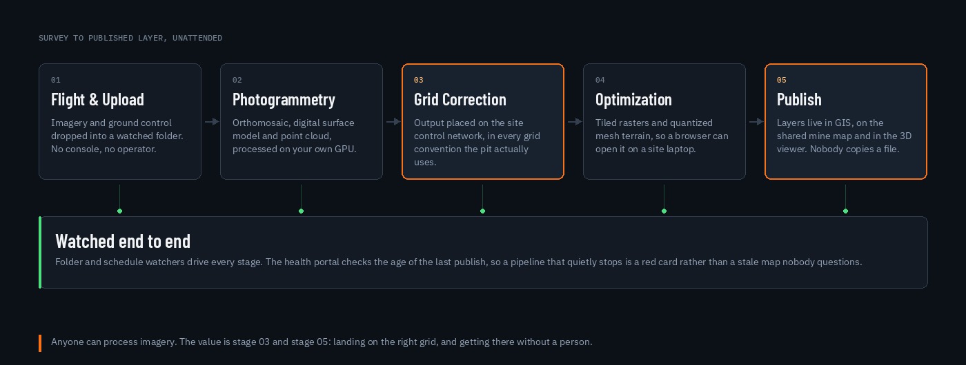
Screenshot from a production system, identifiers altered. It documents an interface, not deployment acceptance or achieved savings.
Documented output
The retained pipeline and portal screenshots document processing and publication interfaces. The public 3D twin illustrates delivery with procedural terrain; it is not a surveyed surface.
Validation and limitations
Accuracy, coordinate control, flight permissions, storage and publication currency are validated for each site. QFieldCloud hosting, DXF validation and the live-map design-management backend are production deployed, including automatic updates to QFieldCloud jobs.