Home / Platforms / Survey & Drone Pipeline

Survey &
Drone Pipeline

The flight is the easy part. What costs a survey department its week is everything after landing: processing, getting the output onto the grid the pit actually works in, converting it into something a browser can open, and putting it where engineering, geology and operations can all see the same thing. This does all of that on your own hardware, watched, without anybody driving it.

Drop the imagery. Come back to a published layer.

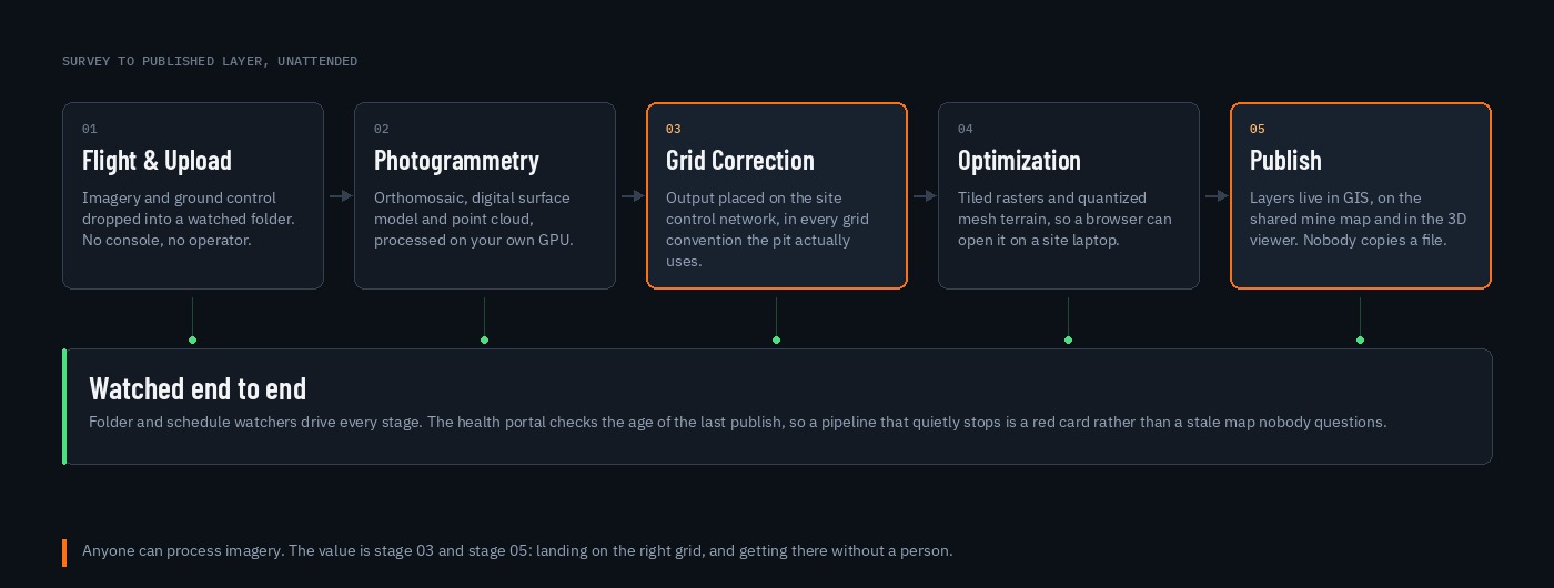
Five stages, none of which needs a person once it is running. Imagery and ground control land in a watched folder and the rest happens on a schedule.

Pipeline diagram: flight and upload into a watched folder, photogrammetry on site GPU producing orthomosaic, surface model and point cloud, grid correction onto the site control network, tiling and quantized mesh optimization, then automatic publishing to GIS, with a watched band beneath every stage
On your GPU

Photogrammetry Without A Subscription

Open-source photogrammetry running on the same server as the rest of the platform. A few hundred images from a live flight processes in hours on a current GPU, and the imagery never leaves the property. No per-hectare pricing, no processing credits, and no queue behind somebody else's job.

The hard part

Every Grid The Pit Actually Uses

Operating mines accumulate coordinate systems: a historical pit grid, a plant grid, a grid inherited with an acquisition, and UTM underneath all of it. Output is placed against a surveyed control network with a proper transform, so survey products, fleet positions and dump records land on top of each other rather than near each other.

Openable

Terrain A Laptop Can Handle

Raw point clouds and full-resolution rasters are useless to everyone except the person with the workstation. Products are tiled and converted to streaming terrain, so the same surface opens in a browser in the dispatch office, in a truck, and in a meeting.

Published

Nobody Emails A File

Finished products are registered as GIS layers automatically and appear on the shared mine map and in the 3D viewer. There is no step where somebody copies a deliverable into a folder and tells people the name of it.

Watched

A Stale Surface Is A Red Card

The health portal tracks how long since the last successful publish. A pipeline that quietly stops shows up as a failed check rather than as a map that everybody keeps trusting for another three weeks.

Audit trail

Provenance On Every Surface

The automated path has no operator, so it records the flight and the run. The manual path does, and it is attributed: a point cloud, orthomosaic or design surface uploaded through the portal is signed by a domain-authenticated user, timestamped, and recorded against the version it replaced. When somebody asks which surface a decision was made against, the answer is a lookup rather than a conversation.

Field

Back Out To The Pit

The same layers reach tablets in the field through mobile mapping, offline capable, so the current surface is available in the places where radio is not.

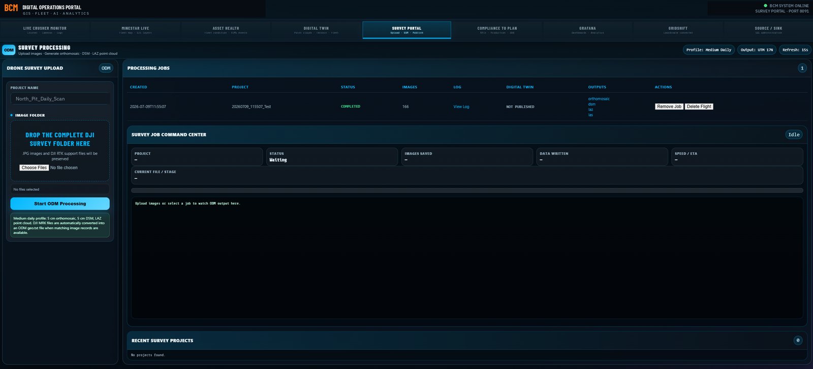
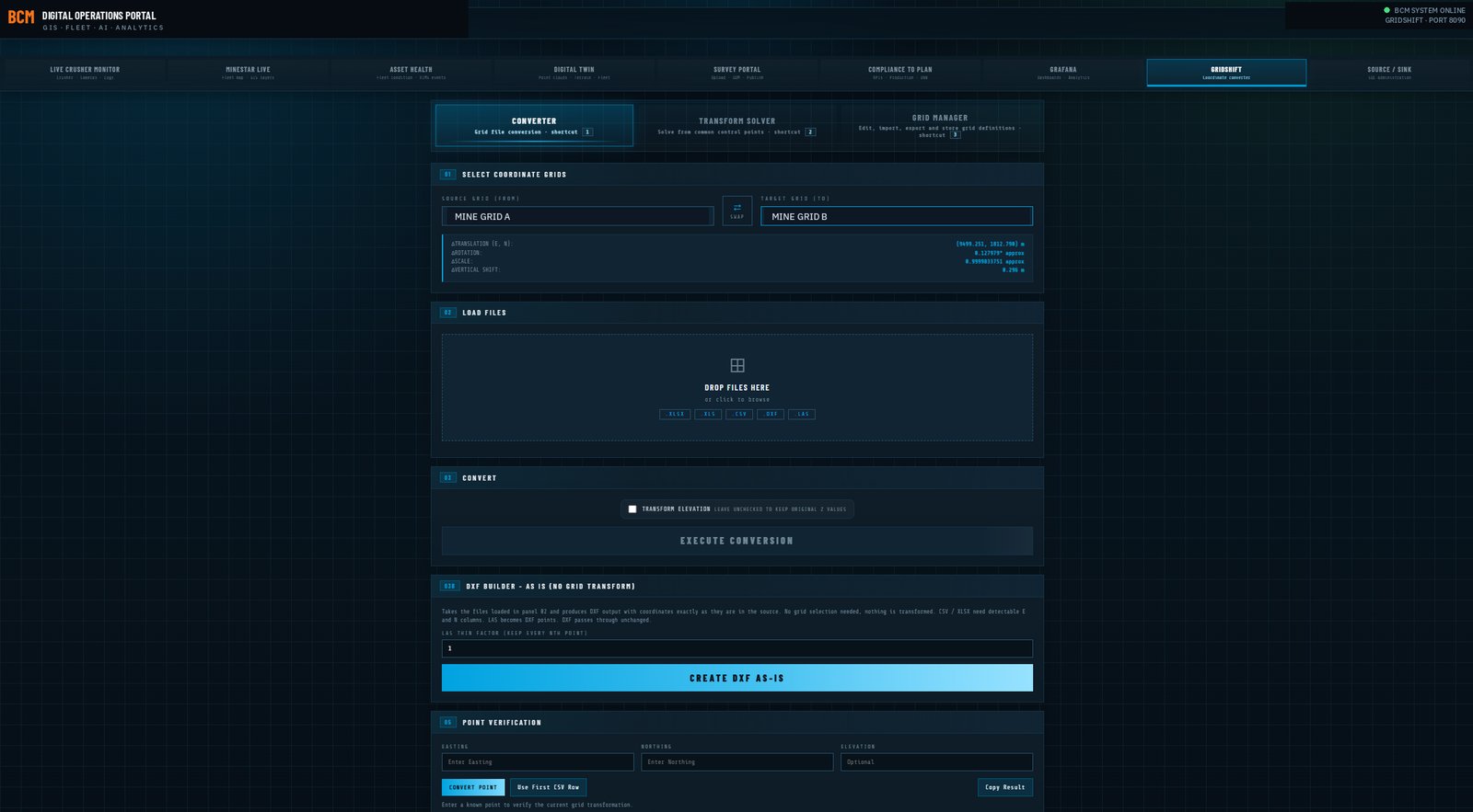
The survey portal and the grid converter.

Two of the pieces, running today: the portal that takes a flight through to published products, and the converter that handles coordinate work interactively when somebody needs a one-off answer rather than a pipeline run.

Survey portal: drone imagery through to published orthomosaic, digital surface model and point cloud in one pipeline
Grid converter: interactive coordinate transformation between mine grid conventions and UTM, with point cloud parsing and CAD export

Why the converter exists: the pipeline handles bulk work, but a surveyor, engineer or geologist regularly needs a handful of points moved between grids right now, and the alternative is a spreadsheet somebody built years ago that nobody wants to audit. This reads survey files directly, converts against the same control network the pipeline uses, and exports to CAD, so the interactive answer and the automated answer cannot disagree.

Screenshots from production systems. Site and personnel identifiers have been altered.

What this replaces.

Per-Site Cloud Photogrammetry

Hosted survey platforms charge per site per year, often with processing metered on top, and your imagery and surfaces live on their side of a login. The processing itself is not the expensive part of that arrangement; the subscription and the data custody are.

Your GPU, your data, no meter

The Week After The Flight

Between landing and a usable published surface there is normally several days of somebody's attention: processing, checking, transforming, exporting, uploading, telling people. That is a skilled person doing file management, every single flight.

Hours of attention, not days

Grids That Nearly Line Up

Most operations have at least one workflow where survey and fleet data are known to be a metre or two apart and everyone works around it. Doing the transform properly, once, against a surveyed control network, removes a whole category of quiet argument.

One control network, one answer

Surfaces Nobody Can Open

A deliverable that requires a workstation and a licence is a deliverable three people look at. The same surface in a browser is one the shift boss checks before sending a truck.

Everyone, not the survey office

Three to five weeks, on your hardware.

How long after a flight before people can use it?

That answer, and how many grid conventions your operation is carrying, is usually the whole scoping conversation. Tell us what you fly and what you pay to process it.